Looking for iron ore on Google Earth, a man found an impact crater that had never been mapped by science
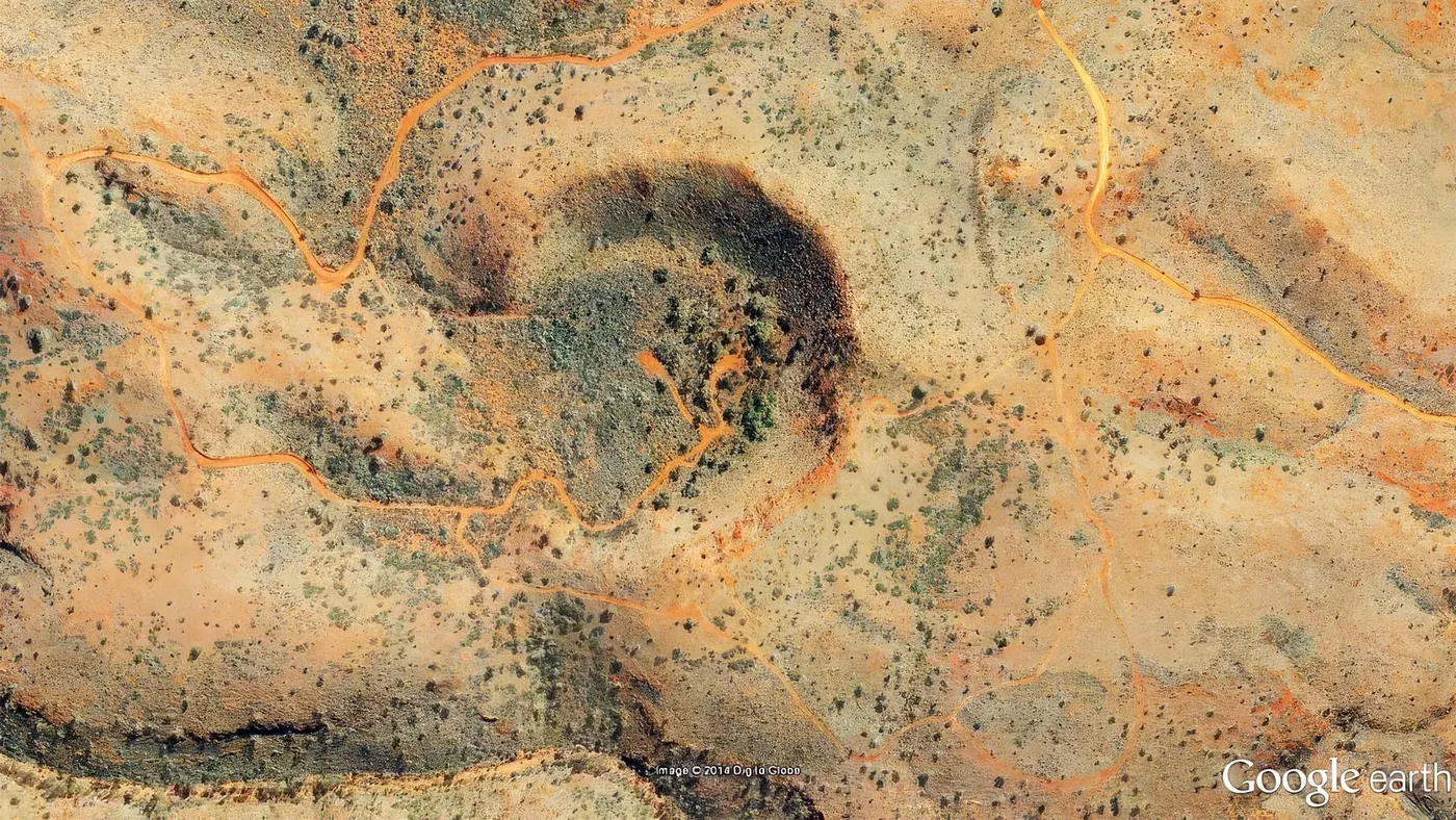
A geologist found an undiscovered meteorite crater in Western Australia on Google Earth in 2007.
Later drilling confirmed its iron meteorite origin.
A geologist found an undiscovered meteorite crater in Western Australia on Google Earth in 2007.
Later drilling confirmed its iron meteorite origin.
In July 2007, geologist Arthur Hickman was scanning satellite images of Western Australia on Google Earth, looking for iron ore.
Instead, he spotted a near-perfect circle in the rugged hills of the Pilbara region.
The feature turned out to be a meteorite impact crater about 850 feet (260 meters) wide.
Despite decades of mining activity nearby, no one had recognized it before.
It took years of fieldwork, drilling and lab analysis to prove that a falling iron meteorite carved it out.
Hickman worked for the Geological Survey of Western Australia ( GSWA ).
At the time, he was searching the imagery for channel iron deposits, a type of iron ore found in ancient riverbeds.
“I was looking from high up at about 20,000ft [6000m] and I saw this bubble-like shape, like a flaw on the image,” he told Australian Geographic .
The circle sits in the Ophthalmia Range, about 22 miles (36 kilometers) north-northwest of the mining town of Newman.
Iron ore exploration and mining have been intense in the surrounding Hamersley Range since the 1960s.
GSWA had also mapped the area roughly two decades before Hickman’s discovery, without noticing the crater, according to a 2008 report in Universe Today .
Hickman sent screenshots and coordinates to colleagues at the Australian National University (ANU).
Researcher Andrew Glikson named the crater after him, in recognition of the discovery and his 35 years of work on the geology of the Pilbara.
The crater has a partly eroded rim that rises up to 98 feet (30 meters) above a flat, circular floor.
Its shape matched that of other small impact craters.
In 2008, Glikson, Hickman and a colleague described the site in detail.
They found shattered rock in the crater rim, cut by veins of the iron mineral goethite, and these features appeared only within the crater zone.
The team estimated that the original crater was about 260 feet (80 meters) deep.
They suggested it was excavated by an object roughly 33 feet (10 meters) across, which threw debris up to about 980 feet (300 meters) north of the rim.
The crater looked young, likely dating to the Late Pleistocene, between 10,000 and 100,000 years ago.
But one key piece of evidence was missing.
Surface samples showed no chemical traces of meteorite material, so the case for an impact still rested mostly on the crater’s shape and fractured rock.
In late 2012, GSWA teamed up with the mining company Atlas Iron to drill a vertical hole in the center of the crater floor.
The core reached a depth of 212 feet (64.7 meters).
Related News
- MiningIndia's 97 GW Coal Expansion Plan Looks Too Small, Senior Official Says
- MiningExplosives: The overlooked risk that could halt mines
- MiningOp-Ed: AI will not just add copper demand. It could change who sets the price
- MiningSouth America’s copper boom faces a $170B reality check
- MiningHertha Metals breaks ground on $100M US plant for magnet-grade iron
- MiningEnergyX inks 10-year, $2B lithium offtake deal with Trafigura